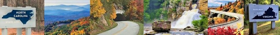
Blue Ridge Parkway FAQ
The Blue Ridge Parkway is the most visited national park in the United States. In 2021 the park had an estimated 15,948,148 visitors. Every year during the month of October the parkway has almost 2 million visitors driving on the parkway to view the fall foliage. Here are some of the most frequently asked questions visitors have about the Blue Ridge Parkway.
-

- Blue Ridge Parkway
-

- Blue Ridge Mountains
-

- BRP In The Fall
Frequently Asked Questions About The Blue Ridge Parkway
Where Is The Blue Ridge Parkway?
The Blue Ridge Parkway is a scenic highway that is located in Virginia and North Carolina. It is part of the national park system. The parkway connects the Shenandoah National Park in Virginia with the Great Smoky Mountains National Park in North Carolina.
What Mountains Do The Blue Ridge Parkway Go Through?

NC Mountains From BRP Fall 2022
The parkway runs through the southern end of the Appalachian Mountains. The Blue Ridge Mountains are a subrange of the Appalachian Mountains. There are six mountain chains in this part of the Appalachians. In Virginia and North Carolina, the parkway runs through the Blue Ridge Mountains. In North Carolina, the parkway winds through the Black Mountains, the Great Craggy Mountains, Mount Pisgah and the Pisgah National Forest, and the Great Balsam Mountains. The parkway ends at the Great Smoky Mountains that border North Carolina and Tennessee.
How many miles long is the parkway?
The parkway is 469 miles long. 216.9 miles are located in Virginia. 276.4 miles are located in North Carolina. The parkway begins near Rockfish Gap in Virginia and ends near Cherokee, North Carolina.
What is the speed limit on the parkway?
The entire length of the Blue Ridge Parkway has a 45 mile per hour speed limit. The parkway was designed for drivers to take their time and enjoy the scenic views.
How long does it take to drive the whole parkway?
It would take you just over 10 hours to drive the entire 469 miles. That’s with no traffic! If the parkway is crowded the drive would of course take longer.
How many overlooks are located on the parkway?

Roanoke River Overlook on BRP VA
There are about 280 pullouts on the parkway with over 200 listed as overlooks. Overlooks can have scenic views of mountains and valleys; creeks and lakes; forests or open fields. Some are only designated parking for trails and hunting areas.
How many tunnels are located on the parkway?
There are 26 tunnels on the Blue Ridge Parkway. There is 1 tunnel located in Virginia and the remaining 25 tunnels are located in North Carolina.
Where does the parkway start?
The parkway begins at Milepost 0 located in Rockfish Gap, Virginia. It begins at the end of Skyline Drive. The parkway connects the Shenandoah National Park in VA with the Great Smoky Mountains National Park in Cherokee, NC.
Where does the parkway end?
Milepost 469 is the southern end of the parkway. It is located in Cherokee, NC. This is the southern entrance to the Great Smoky Mountains National Park.
What are the highest and the lowest points on the parkway?
The parkway winds through the central and southern Appalachian Mountains. The lowest point is located at James River in VA which is at 649 feet. The highest point on the parkway is at Richland Balsam in North Carolina. There the elevation is 6047 feet.
Are there visitor centers located on the parkway?

Blue Ridge Parkway Visitor Center
There are 15 Visitor Centers located on the parkway. Six are located in Virginia and 9 are in North Carolina. There are also 3 cultural life demonstration areas all located in Virginia. Most visitor centers are seasonal and open only from May through October. Three are 3 that are open year-round. The Blue Ridge Parkway Visitor Center (MP 384), the Folk Art Center (MP 382) and the Museum of North Carolina Minerals (MP 331) are all open year-round (closed on Thanksgiving, Christmas Day and January 1st).
Is The Parkway Road Always Open?
The Blue Ridge Parkway road is open year-round. But sections can be closed due to ice and snow, storm damage, or construction or maintenance activities. Winter weather and storm damage can result in the parkway road being closed. Weather-related closures can change quickly. The best way to know about closures is to go to NPS Blue Ridge Alerts and Conditions.
Can You Get Gas On The Parkway?
No gas stations or EV charging stations are located directly on the Blue Ridge Parkway. You must exit the parkway to buy fuel or find an EV charging station.
Can You Drive A RV Or Pull A Camper On The Parkway?
Yes, you can but there are risks. Not all RVs or campers will go through the tunnels. Parking can be limited at visitor centers and overlooks. Also gas is not available on the parkway, you must exit off the parkway to fuel up. Overhanging tree limbs may be a problem for tall RVs and campers. Another problem can be having to drive at a lower speed than 45mph. Some sections of the parkway can be steep and winding.
Can You Park On The Side Of The Road On The Parkway?
No, you can not. Parking is limited to designated parking lots or overlooks. Avoid parking on the side of the road unless it is a designated pullover, overlook, or parking lot. You are not allowed to sleep in your car overnight.
Do I Have To Pay A Fee To Drive On The Parkway?
No, there is no fee or charge to drive on the parkway.
What To Do If There Is An Emergency…
Call 911. But know that cell phones do not work in many locations along the Parkway due to the mountainous terrain. Also, GPS can be unreliable while driving on the parkway.
Report a missing person or a lost or overdue hiker-Contact the Comm Center by phone at 828-298-2491.
Have or see a disabled vehicle-call for local roadside service or tow company. Park Rangers and the park service do not deliver gas, pull stuck vehicles from mud, or provide vehicle maintenance assistance.
