BRP Closes Section For Bear Encounters

BRP Closes For Bear Safety

BRP closes for bear safety reasons at an 8-mile-long section in NC. Blue Ridge Parkway officials are closing a section of the parkway temporarily. Several calls were made recently about multiple interactions between humans and a young bear. The 8-mile section closed is located at milepost 372.1 The Lane Pinnacle Overlook.

BRP closes for bear safety

BRP closes for bear safety

“There were multiple reports of visitors feeding and attempting to hold a young bear at the Lane Pinnacle Overlook. Several pictures posted on social media showed the young bear very close to a crowd of onlookers. There was even a photo of people leaving food on the railings and the bear eating the food.

Earlier in October there were similar interactions witnessed between a young black bear on the parkway. One social media post showed a bear at Lane Pinnacle Overlook walking around a parked motorcycle. Another witness shared an image of a young bear walking around a crowded overlook in the Craggy Gardens.

Temporary Closure BRP Near Lane Pinnacle Overlook

“We are closing this section of the road temporarily for the safety of both the bear and park visitors,” said Superintendent Tracy Swartout. “When people intentionally attract bears with trash and food it can lead to very dangerous situations. In this instance, we want to give the bear a chance to lose interest in the area before the situation escalates and visitors or the bear is harmed.

Lane Pinnacle Overlook BRP NC

Lane Pinnacle Overlook BRP NC

The Blue Ridge Parkway between milepost 367.6 near the Craggy Gardens Picnic Area to milepost 375.6 at Ox Creek Road is closed starting today, 11/1/23 until further notice. Visitors can access the Craggy Gardens recreational area by using NC80 from the north. The visitor center at milepost 364.5 will remain closed until the section reopens.

During fall bears forage for food. They need to put on weight in preparation for the upcoming winter and hibernation. During this time bears actively seek out natural foods such as berries and nuts. Bears have an excellent sense of smell. Smells attract bears. They can smell and will eat human foods. They can also learn to associate humans with food which can lead to a dangerous situation. Never feed a bear. And stay at least 150 feet from bears and any other wildlife.


Bear Safety Tips

Bears – observe from a distance. Do not leave food or offer food to the bear. If you suddenly come upon a bear remain calm, quiet, and slowly back away. Do not turn your back to the bears. More bear safety guidelines can be found at NPS.


The parkway official asks if you or anyone else encounter a bear while on the parkway, call 828-298-2491 or stop at the nearest Visitor Center to report the encounter.


Share

Cherokee To Graveyard Fields On the Parkway

Cherokee To Graveyard Field- A ride on the Blue Ridge Parkway

Everyone has their favorite section of the Blue Ridge Parkway. Cherokee to Graveyard Fields is a favorite for many visitors. A well-known section of the parkway is near Boone, NC. The Linn Cove Viaduct is the most photographed section of the parkway. But there are other sections of the Blue Ridge Parkway in North Carolina that also offer gorgeous views of the southern end of the Blue Ridge Mountains. The highest peak (at 6,053 feet) on the parkway is on this section. The highest peak on the Blue Ridge Parkway is located at Richland Balsam as it passes over Richland Balsam’s southwestern slope.

Mt Mitchell from parkway

Mt Mitchell View From Parkway


Mount Mitchell is the highest peak of the Appalachian Mountains.  It is not located in the southern section of the Blue Ridge Parkway. Mount Mitchell is north of Asheville in the northern section of the parkway. It is located near Burnsville in Yancy County, NC. Mount Mitchell is visible in the distance from many of the overlooks on the Blue Ridge Parkway. To visit you must exit the parkway. Mount Mitchell and Mitchell State Park are only accessible from the Blue Ridge Parkway by exiting at Milepost 355.4  and taking NC 128 near Black Mountain Gap.

Cherokee To Graveyard Fields

Leaving Cherokee and taking the Blue Ridge Parkway, there are many beautiful overlooks and stops in this lesser travel section of the parkway. In the fall peak colors appear first in many mountain ranges in this part of Western North Carolina. From Cherokee, it takes about an hour to reach Graveyard Fields by the parkway. The speed limit is 45mph. A two-hour round trip there and back to Cherokee is a great way to view some of the highest peaks of the Blue Ridge Mountains.

In Cherokee and just south of the Great Smoky Mountains National Parks, is the junction of the Blue Ridge Parkway and US441. This is the southern end of the BRP with the marker final marker being Milepost 469.1. As you travel along the parkway the mile markers will be decreasing.

Cherokee To Graveyard Fields Overlooks To Enjoy

The first overlook is the Oconaluftee View Overlook at MP 468.4. Looking down from the overlook is a nice view of the Oconaluftee River. The overlook view is on Raven Fork in the Great Smoky Mountains National Park. Cherokee is just minutes away from the southern entrance to the BRP.

Big Witch Overlook at MP 461.9  has an elevation of 4160 feet. The name comes from the last great Cherokee medicine man Big Witch. The view is a prelude to the majestic peaks and valleys you will see along the parkway in this part of the Blue Ridge Mountains.

Watterrock Knob Overlook and Parking is at MP 451.2 with an elevation of 5,820 feet.  Waterrock Knob is the location of the highest parkway’s visitor center. The overlook has beautiful long-range views of Appalachian mountain chains. Sunsets and sunrises can be viewed at Waterrock Knob. At the visitors center, you can take a steep trail from the center to the top of Waterrock Knob. The trail is 1.2 miles round-trip. The summit is at 6,273 feet and is the highest point on the parkway. Waterrock Knob is located in the Plott Balsams mountain chain between the Great Smoky Mountains and the Great Balsam Mountains. 

Woolyback Overlook

Woolyback Overlook

Woolyback Overlook is at Milepost 452.3 with an elevation of 5425feet. From this overlook, you can see the mountainside covered in rhododendron and mountain laurel. The shrubs cover the ridge creating a wooly look. At The Orchards Overlook at MP 444.6 is a view of an old apple orchard that covers the valley of Richland Creek. The overlook has an elevation of 3810feet. It is located in Jackson County, NC near Waynesville.

Balsam Gap Overlook is located at MP 442.2 on the parkway. The overlook is at an elevation of 3630 feet. The view is not a long-range view of mountains and valleys, but of the forest. Balsam and other trees are located in this area of the mountains. Balsam Gap is a mountain pass between the Plott Balsam Range and the Great Balsam Mountains. The Gap is the county line divider for Haywood and Jackson counties. The gap is named for the Great Balsam Mountains in which it lies. Just off the parkway at MP 443.1, take US 23-74 to nearby Balsam, NC.

View Waynesville Overlook is at Milepost 440.9 with an elevation of 4110 feet. At this overlook, you can see the nearby town of Waynesville, NC. The town is situated below in a valley of the Plott Balsam range. It’s a nice scenic view of Waynesville in the distance surrounded by mountains.


Cowee Mountain Overlook

Cowee Mountain Overlook

Cowee Mountains Overlook at Milepost 430.7 with an elevation of 5950 feet. This is a popular overlook due to the beautiful view from the parking lot. Just steps out of your vehicle you can take a photo. Mountain range after mountain range, the view is spectacular. If you happen to be at this overlook at sunset you will be gifted with a gorgeous view of the settling sun behind the Nantahala National Forest.


Richland Balsam Overlook

Richland Balsam Overlook

Richland Balsam Overlook is at MP 431.4 with an elevation of 6053 feet. This is the highest point of the Parkway. The overlook gives views of the southern Appalachian Mountains. From the overlook, you can see the Cowees, Nantahalas, and Plott balsams. The highest point you can drive to on the parkway is located at Richland Balsam, elevation 6,047 feet. There are two overlooks for Richland Balsam, near Milepost 431. Haywood-Jackson Overlook. is one. This is where you park for the 1.5-mile loop hike to the top of Richland Balsam. The second is at MP 431.4. There is a large sign  ” 6053 feet Highest Elevation Blue Ridge Ridge Parkway Motor Road”.

View Devil’s Courthouse at this BRP overlook at Milepost 422.4. The elevation here is 5462 feet. See the rough and rocky summit of Devil’s Courthouse in the distance. The name comes from the rough and rocky summit that has a devilish appearance. The view from the overlook is nice but the view from the summit is way better. Devil’s Courthouse is one of the most prominent and recognizable mountains along the parkway. For hikers, there is a trail from the parking area to the summit. The summit has a panoramic view of the Pisgah National Forest. Devil’s Courthouse summits at an elevation of 5,720 feet. Due to its elevation, it is one of the first locations on the parkway for fall foliage to appear and peak.

Graveyard Fields Overlook is at MP 418.8 with an elevation of elevation 5120 feet.  This area is one of the most popular hiking areas along the parkway. Even in the summer, this area can be quite cool. In the fall this area is one of the first locations along the parkway for fall foliage to appear. In the winter this section of the Parkway is often closed for dangerous road conditions due to ice and snow.

Graveyard Fields View

Graveyard Fields View


Graveyard Fields valley can be filled with wildflowers, blueberries, and colorful fall shrubs. The valley is surrounded by tall mountain peaks of the surrounding mountain chains. The name came from how years ago the tree stumps looked like gravestones in a graveyard yard. But years ago storms and a brushfire changed the appearance. There are three waterfalls in the Graveyard Fields that are easily accessible from the Blue Ridge Parkway.

Cherokee Or Asheville

Graveyard Fields is approximately 50 miles from Cherokee. At this point, you can turn around and head back. You can stop at some of the many other overlooks you passed getting to Graveyard Fields. Or you could continue towards Asheville on the parkway. Asheville is 32 miles from Graveyard Fields. The trip to Asheville would be another hour of driving on the Blue Ridge Parkway at 45mph if the parkway isn’t too crowded.

More Views From The Blue Ridge Parkway


Share

Hang Glider Dies In Shenandoah Valley

Hang Glider Dies In Shenandoah Valley After Losing Control

A hang glider dies after hitting a tree in the Shenandoah Valley region of Virginia. Virginia State police are investigating the death of a 71-year-old man after he, the pilot of his hang glider crashed into a tree. The man was hang gliding the afternoon of Thursday, March 3 about 30 miles southwest of Front Royal near Woodstock. He apparently lost control of the hang glider, crashed into a tree, and fell to the ground. The man identified as Ward F. Odenwald, of Woodbine, Md., died at the scene of the crash. His remains were transported to the Medical Examiner’s Office in Manassas for an autopsy and examination. The FAA was notified of the fatal crash, which is under further investigation.

Hang Gliding

Fatal Hang Gliding Accident in SNP


This is the second hang gliding crash in Shenandoah National Park since the beginning of March. The day before, on March 2, a person hang gliding in Shenandoah National Park needed help when he became trapped in a treetop after accidentally flying into the tree. The man was not injured. Skyline Drive had to be closed for almost an hour while first responders helped get the man out of the tree.

Share

Blue Ridge Parkway Homicide

Blue Ridge Parkway Homicide

The Blue Ridge Parkway homicide investigators are asking for assistance from parkway visitors that were in the park on October 9, 2021. The National Park Service Investigation department is asking for photos, videos or other images visitors took that day.  If anyone was on the Blue Ridge Parkway on October 9, 2021, and took pictures, videos, used a GoPro or any other type of imaging device please contact the investigators.

Update On Homicide Investigation

Update on 11/17/2021: Two men from Rhode Island have been charged with the homicide of Jorge Garcia. Juan Rivera and Julio Castro have been charged with shooting and killing Garcia at a restaurant in Providence, RI on Sept. 25, 2021. The same two men, Rivera and Castro, are being linked to a murder investigation in North Carolina. Police report the two are being looked at in connection with the discovery of a body of the Rhode Island man Josue Calderon. Calderon’s body was found on the Blue Ridge Parkway in North Carolina on October 9th.

Blue Ridge Parkway Homicide

Blue Ridge Parkway Homicide


On October 9th a body was found near a park overlook. The body was found below the Yadkin Valley Overlook at Milepost 289.9.  The cause of death was ruled a homicide. If anyone was in that area on that day and has pictures, video, or images they may be helpful in the homicide investigation. The park service is asking for those images.

Blue Ridge Parkway Investigation Update

The following was posted by the Blue Ridge Parkway investigators…

11.03.2021 UPDATE:

Investigators with the National Park Service are asking for the public’s help to provide photos or videos in support of an ongoing homicide investigation on the Blue Ridge Parkway.

On Saturday afternoon, October 9, 2021, parkway personnel received a report from a park visitor of a body near a parkway overlook. Law enforcement rangers responded to the scene and located a deceased male below Yadkin Valley Overlook at Milepost 289.8. Investigators identified the victim as Josue Calderon, age 33, of Rhode Island. An autopsy conducted by the North Carolina State Medical Examiner’s Office determined cause of death to be homicide.

Though no further details are available at this time, information from other travelers and visitors is often very helpful to investigators. If you took photographs or videos (cell phone, GoPro, etc.) on the Blue Ridge Parkway anywhere in North Carolina on October 9, 2021, or if you have any other information that could help, please submit a tip. You don’t have to tell us who you are, but please tell us what you know:

CALL or TEXT the ISB Tip Line 888-653-0009
ONLINE go.nps.gov/SubmitATip
EMAIL nps_isb@nps.gov
EMERGENCY dial 9-1-1

This was also recently posted on the Blue Ridge Parkway social media…
Investigators with the National Park Service are asking for the public’s help to provide photos or videos in support of an ongoing homicide investigation on the Blue Ridge Parkway.
If you took photographs or videos (cell phone, GoPro, etc.) on the Blue Ridge Parkway anywhere in North Carolina on October 9, 2021, or if you have any other information that could help, please submit a tip using the process in the linked post below. Learn more at: go.nps.gov/nhcd2t

Location of Yadkin Valley Overlook on the Blue Ridge Parkway North Carolina

Yadkin Valley Overlook, Aho, North Carolina

Share

BRP by Sections – South of Asheville

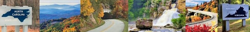
Blue Ridge Parkway By Sections – South of Asheville

The Blue Ridge Parkway south of Asheville is the last section to be described. This is the final section of this three-part parkway by section article. The last 85 miles of the parkway winds through the Pisgah National Forest and ends at the entrance to the Great Smoky Mountains.

BRP South Of Asheville

The Blue Ridge Parkway crosses I-40 at MP 384. Take I-49 west and Asheville is a short drive away. At MP 384 there is the Blue Ridge Parkway Visitors Center. It has an information desk, exhibits, a 22″ interactive map, and an informative 24-minute movie about the parkway.

After leaving the BRP Visitors Center, about 7 miles south on the parkway is the I-26 Overpass. It is located at MP 391.8. This section of the Blue Ridge Parkway starts to winds through the Pisgah National Forest. The Pisgah National Forest is over 500,000 acres in size. Mount Pisgah has an elevation of 5,722feet.  Within the national forest, there are some of the highest mountain peaks located along the parkway.

Grassy Knob Tunnel

Grassy Knob Tunnel

At MP393 the BRP crosses the French Broad River. The French Broad Overlook offers a nice view of the river. It is one of the oldest rivers in the world. In places, it is calm and shallow, and in other places steep with rapids. White water rafting The French Broad River is a popular sport due to the Class II and III rapids.

Knob Tunnel is located at MP 397.1. The Grassy Knob tunnel is 600 ft long. This is one of 26 tunnels on the BRP in NC. After this one there are 17 more tunnels before you reach MP 469!

Panoramic Views

At MP 409.6 is Fryingpan Mountain Lookout Tower. Enjoy panoramic views from Fryingpan Mountain Lookout Tower after a short hike from the Blue Ridge Parkway. People can climb the first 5 flights of the lookout tower, but the very top of the tower is locked and not accessible to the public. Look south from the tower and see a great view of Looking Glass Rock.

Looking Glass Rock Overlook is at MP 417 on the parkway. Looking Glass Rock has an elevation of 4000 feet. This portion of the parkway is one of the first to peak during the fall foliage season due to the high elevations.

Graveyard Fields

Graveyard Fields in October


Another well know area that fall foliage appears first is Graveyard Fields located at MP 418.8. The field is a flat mountain valley nestled in the Blue Ridge Mountains. The valley sits at over 5,000 feet in elevation. The valley is surrounded by mountains that are over 6,000 feet in elevation. Graveyard Fields is one of the very first areas in the fall that show fall colors.

View of Four States From This Lookout

Devil’s Courthouse is at MP 422.4 The elevation at the peak is 5720 ft and another location that develops fall color early. From the summit, after a strenuous half-mile walk, there is a panoramic view of the surrounding mountains. The view includes four states: North Carolina, South Carolina, Georgia, and Tennessee.

At an even higher elevation than Devil’s Courthouse is Waterrock Knob at MP 451.2. The summit is 6,293 feet in elevation and is the highest point on the parkway. The visitors center is at 5,820 feet and is the Blue Ridge Parkway’s highest elevation visitors center. From the summit of Waterrock Knob, you can view both the sunrise in the east in the morning and the sunset in the west in the evening. This is another great place to catch the fall foliage earlier than most areas due to the high elevations.

MP 469 Welcome to the Smokies

And finally, the last stop on the BRP is MP 469 which is located in the Great Smoky Mountains. The last overlook is the Oconaluftee Overlook near the town of Cherokee. The BRP ends at US 441. Head south and Cherokee is a few miles away. Head north on 441 (also known as Newfound Gap Rd) and you can enjoy a ride through the Great Smoky Mountains National Park.

Points of Interest on the Blue Ridge Parkway Section South of Asheville

  • MP 408.6  Mount Pisgah – campground, picnic area, trails. Pisgah Inn is at MP 408. The inn is known as “Peak of the Parkway” because of the elevation level of 5,000 feet. The inn offers panoramic views of the surrounding Pisgah National Forest.
  • MP 412.2 Wagon Road Gap – US 276 crossover. Exit off BRP toward either Brevard and Waynesville
  • MP 417  Looking Glass Rock – elevation 3,970 ft. Part of the Pisgah National Forest. The mountain is named for the way the granite face reflects the sunshine, snow, or ice.
  • MP 418.8 Graveyard Fields Overlook – a great view of the mile-high valley with waterfalls and rolling ridges. One of the first locations to develop fall colors due to the high elevation.
  • MP 422.4  Devil’s Courthouse Parking Area – the strenuous half-mile hike is worth the 360-degree view when you reach the summit. Devil’s Courthouse summit is at 5,720 feet. This is another area on the parkway that develops fall foliage first due to the high elevation.
  • MP 431 Haywood-Jackson Overlook – has a trail to the summit of Richland Balsam. Having an elevation of 6,410 feet, it is the highest mountain in the Great Balsam range. It is among the 20 highest summits in the Appalachian Mountain Range.
  • MP 431.4 Richland Balsam Overlook – the highest point on the Blue Ridge Parkway scenic bypass road. The altitude here is 6,047.
  • MP 443.1 Balsam Gap – US 74-23 crossover. Exit to Waynesville and Syva and Dillsboro
  • MP 451.2 Waterrock Knob Parking Overlook – the view is of 4 states: North Carolina, South Carolina, Georga, and Tennessee. Plus views of the Great Smoky Mountains. Visitor Information Center, comfort station, and trail.
  • MP 455.7 Soco Gap – US 19 crossover. Exit to Cherokee, and Maggie Valley.
  • MP 469  End of Blue Ridge Parkway. Junction with US 441. Exit to Cherokee, NC, Gatlinburg, TN ae Great Smoky Mountain National Park.


Images Along the Way On The BRP South of Asheville


Map of BRP South of Asheville

Cherokee, North Carolina

Maggie Valley, North Carolina

Blue Ridge Parkway Ends at US 441

Waterrock KNob

Richland Balsam Area on the BRP

Devil's Courthouse Parking Area

BRP in the Pisgah National Forest


Grassy Knob Tunnel 

on BRP

Asheville, North Carolina

BRP Juction with I-40


Be sure to read all 3 parts of the posts Blue Ridge Parkway By Sections.

Here are the links to each of the three posts.

Share

Blue Ridge Parkway North of Asheville

Blue Ridge Parkway By Sections – North of Asheville

The Blue Ridge Parkway north of Asheville is the next section to be described. The entire Blue Ridge Parkway is 469 miles long. Of those 469 miles, 253 miles are in North Carolina. The section of Blue Ridge Parkway north of Asheville alone is about 168 miles long. Driving at a speed limit of 45 miles per hour will result in a long trip. Being familiar with the different sections of the parkway will make it easier to plan your adventure. Part One of the Blue Ridge Parkway By Sections covered Virginia. Now let’s concentrate on the Blue Ridge Parkway in North Carolina north of Asheville and I-40.

The Blue Ridge Parkway in North Carolina starts at MP 216.9 at the NC/VA state line. This section may be the most well-known section of the parkway. Just after crossing the state line Cumberland Knob Recreation Area is the first large park. Cumberland Knob Recreation Area is located at MP 217.5. Traveling further south is Doughton Park, another large and popular park area.  Doughton Park is at MP 238.5. Located here are a Visitor Center and Park Store, the newly renovated Bluffs Restaurant, hiking trails, a campground, and a picnic area.

Grandfather Mountain and Linn Cove Viaduct

Flat Top Manor

Flat Top Manor and Estate at the Moses H. Cone Memorial Park

One of the most widely known sections of the parkway is near the towns of Boone, Blowing Rock, and Linville. Moses H. Cone Memorial Park is located at MP 294. Stop here to explore Flat Top Manor and Estate (also called the Moses Cone Manor).  The manor has 23 rooms and was built as a Colonial Revival summer mansion in 1901. The estate covers 3,500-acres. Trails are available for horse-drawn carriage rides, horseback riding, and hiking. The Craftsman’s Trail is a 20-minute loop walk around the manor.

At MP 302.8 is Rough Ridge. It has beautiful mountain views of nearby Grandfather Mountain and the Linn Cove Viaduct. Keep on the parkway to MP 304.4 and you are driving across the Linn Cove Viaduct that you just viewed from Rough Ridge. Stop at the nearby Linn Cove Visitor Center for information about the construction of the famous viaduct.

Continuing south on the parkway at MP 328.3 is the Orchard at Altapass. It’s another one of the most visited locations on the Blue Ridge Parkway. The apple orchard grows and sells heirloom apples. There is also a bee habitat, U-Pick, storytelling, “heyrides”, music, mountain heritage information, and of course spectacular views. The Orchard at Altapass is a great place to stop for a snack. They have hand-scooped ice cream, hot apple pie, and homemade fudge.

Mount Mitchell and Craggy Gardens

Mount Mitchell

Mount Mitchell
Yancey County, NC

Mount Mitchell is located at MP 355.4 on the parkway. Mount Mitchell has the highest peak of the Appalachian Mountain Range. It is also the highest point east of the Mississippi River with an elevation of 6684 feet. Mount Mitchell State Park can be accessed by the parkway at MP 355.4. The entrance to Mount Mitchell State Park is marked on the parkway. It is a 4.5-mile drive to the summit. MMSP has 1,946 acres to enjoy. The park is free to visit with no admission fee.

Craggy Gardens and the Craggy Gardens Visitor Center are located at MP364.4. At MP 364.1 there is a trail that leads to panoramic views from Craggy Pinnacle. With an elevation of 5,892 ft, this is one of the first areas on the parkway to display fall foliage. Craggy Gardens trails and a picnic area are at MP 367.6. Visitors also flock here in June to view the colorful flowering blooms of the Catawba rhododendrons.

Asheville

The Blue Ridge Parkway crosses I-40 at MP 384. Take I-49 west and Asheville is a short drive away. At MP 382 is the Folk Art Center. The center is a museum of Appalachian arts and crafts. It houses the Southern Highland Craft Guild’s Allanstand Craft Shop, exhibitions in three galleries, a library, an auditorium, a book store, and a parkway information desk.

Areas of Interest on The Blue Ridge Parkway North of Asheville

  • MP 216.9  Virginia/ North Carolina State Line
  • MP 217.5  Cumberland Knob – 1000 acres, picnic area, comfort station, short loop trail
  • MP 238.5 Doughton Park – 7000 acres, picnic area, campground, comfort station, trails,. Brinegar Cabin
  • MP 241  Bluffs Lodge and Bluffs Restaurant – a 24‑acre landscape set within Doughton Park with views of the roadway, the lodge, Wildcat Rocks Overlook, and the water tower. Bluffs Restaurant with recent renovations and a new menu. A great place to stop for a break ad grab something to eat.
  • MP 259  Northwest Trading Post – located in Ashe County. The trading post has crafts, snacks, jams, jelly, and other gift items.
  • MP 276  Deep Gap – Junction with US 421. Boone is 11 miles away
  • MP 292 and MP 294 – Moses H. Cone Memorial Park. Moses H. Cone built this 23 room summer retreat in 1901. Now listed on the Register of Historic Places. Visit Flat Top Manor and estate, now known as the Moses H. Cone Memorial Park. Carriage trails, historic manor, and the Southern Highland Craft Guild craft shop.
  • MP 297 Julian Price Memorial Park – Over 4000 acres including picnic areas, lake, boating, fishing, and hiking trail. Also has a campground.
  • MP 304 Linn Cove Viaduct Information Center – visitor information, publications, maps, pamphlets. Trail access to the viaduct. A great place to take pictures.
  • MP 304.4  Linn Cove Viaduct – a 1,243 feet long, concrete segmental bridge that winds around Grandfather Mountain. The combination of landscape, bridge architect, and engineering results in beauty and functionality. The viaduct is the most photographed site on the Blue Ridge Parkway.
  • MP 305.2  Junction with US 221. Located near Grandfather Mountain. Take US 221 south to Linnville. Take US 221 north to Blowing Rock. In Linville on US 221 take US 105 north to Sugar Mountain, Banner Elk and Valle Crucis.
  • MP 316.3 Linville Falls Vistors Center – Parking area at Linville River. Stone arch bridge. Fish, picnic, campgrounds
  • MP 320.7 Chestoa View – great view of the cliffs on Humpback Mountains
  • MP 355.4  Mt. Mitchell exit. The highest peak east of the Missippissi at an elevation of 6,684 feet. Mt. Mitchell is located in the 1,855-acre Mt. Mitchell State Park. Mt. Mitchell State Park is only accessible from the Blue Ridge Parkway by taking NC 128 at Milepost 355.4 to the summit.
  • MP 339.5 Crabtree Falls – 250 acres with hiking, camping, picnic area, comfort station, information, and WI-Fi
  • MP 364 Craggy Gardens – visitors center and views of the Great Craggy Mountains, commonly called the Craggies. Jagged rocky “crags” with high elevation summits. In spring Craggies is covered with beautiful floral blooms. In fall this area is one of the first areas on the parkway to display fall foliage.
  • MP 382 – Folk Art Center – museum of Appalachian arts and crafts. It houses the Southern Highland Craft Guild’s
  • MP 384 Blue Ridge Parkway Visitors Center – information desk, exhibits, 22″ interactive map, 24-minute parkway film. Also where RBRP junctions with I-40.


Blue Ridge Parkway North of Ashville Photos

Map of the Blue Ridge Parkway – Northern NC Section

BRP Junctions With I-40

Asheville, North Carolina

Craggy Gardens at the BRP

Little Switzerland, North Carolina

The Orchard at Altapass

BRP

Grandfather Mountain

Near Banner Elk, North Carolina

Julian Price Memorial Park

BRP NC

Cone Manor and Estate on BRP

Blowing Rock, North Carolina

BRP Junction with US 421

near Boone, North Carolina

Bluff Mountain near

Laurel Springs

Cumberland Knob

BRP  NC North

BRP

Glendale Springs, North Carolina

Boone, North Carolina


Be sure to read all 3 parts of the posts Blue Ridge Parkway By Sections.

Here are the links to each of the three posts.

Share

Folk Art Center Bear Attack

NPS News Release About Folk Art Center Bear Attack Near Asheville

Folk Art Center bear attack news release by the National Park Service. On Wednesday there was a bear attack at the Folk Art Center near Asheville. This is a copy of the news release put out by the National Park Service. As a result of the attack, several areas near the Blue Ridge Parkway have been closed. For your safety please read and be aware if you are traveling in the area.

News Release: Bear Attack near Folk Art Center prompts area trail closures and food prohibitions on the Blue Ridge Parkway
A couple was treated for injuries and released Wednesday evening after a bear attack in the parking area of the Folk Art Center on the Blue Ridge Parkway.
The couple was having a picnic on a grassy hill near the Folk Art Center, when they were alerted to a bear by their dog. The unleashed dog ran towards the bear while barking loudly. Likely aggravated by the dog, the bear acted defensively toward the dog and the couple. Over the next several minutes, there were repeated attacks by the bear while the couple retreated with their dog to the safety of their vehicle. The couple drove to Mission Hospital where they were both treated for their injuries and released.
Due to the bold and aggressive nature of this attack, temporary closures are in place on all trails in the area and outdoor food is currently prohibited.
Closures and restrictions include:
– The Mountains to Sea Trail from the intersection with the Visitor Center Loop Trail near parkway milepost 384 to Riceville Rd. Bridge at milepost 382
– The Folk Art Center Nature Loop Trail and all trails accessed off of Bull Mountain Road
– Picnicking is prohibited between the Asheville Visitor Center and adjacent parking areas near parkway milepost 384 to the Haw Creek Overlook near milepost 380
During the busy fall visitation season on the Parkway, visitors are reminded that the fall is also a critical feeding period for bears before they enter winter hibernation. Park visitors are reminded to take necessary precautions and be BearWise while in bear country, including properly following food storage regulations, keeping pets leashed and remaining at a safe viewing distance from bears. If attacked by a black bear, rangers strongly recommend fighting back with any object available and remember that bears may view you and your pets as prey. Though rare, attacks on humans do occur, and can cause injuries or death.
Park rangers and wildlife biologists, in coordination with NC Wildlife Resources Commission (NCWRC), are attempting to capture the bear and conducting and foot patrols of the immediate area. A thorough investigation of the scene was conducted and forensic evidence was collected to be used for DNA analysis. If the offending bear is captured and positively identified, officials will humanely euthanize the animal, per park and NCWRC protocol.
For more information about bear safety please visit the park website: https://www.nps.gov/blri/planyourvisit/bear-safety.htm

Folk Art Center on BRP

Near Asheville, NC

Share

Blue Ridge Parkway by Sections – Virginia

The Blue Ridge Parkway Sections – Virginia

The Blue Ridge Parkway is 469 miles long and is located in two different states. The Blue Ridge Parkway sections help differentiate the three main sections by location. With a speed limit of 45 miles per hour, it would take over 10 hours to travel the length of the entire BRP. Ten hours of riding with no stops. Many travelers just don’t have that much time. And the parkway is made to stop, relax,  enjoy the scenery,  shop at the visitor centers, picnic at a shelter,  or take a hike on a mountain trail. So knowing exactly where to go helps save time and driving time. I’m going to divide the Blue Ridge Parkway into sections and point out some of the attractions for each section in Virginia and in North Carolina

Skyline Drive

Skyline Drive is located in northern Virginia. It is not part of the BRP, but it is worth mentioning. At the end of Skyline Drive at MP 105 is the beginning of the BRP MP 0. Skyline Drive is 105 miles long. It begins in Front Royal, VA, and ends at Rockfish Gap. The speed limit is 35 miles per hour. There are 4 entrances to Skyline Drive. There is a fee, $30 per vehicle, $25 per motorcycle, and $15 per person. The passes are good for 7 days.

Shenandoah National Park

Shenandoah National Park


Skyline Drive has over 70 overlooks as you wind in and around the ridges of the Blue Ridge Mountains and the Shenandoah National Park. It offers wonderful views of the mountains and valleys as well as the national park. While traveling Skyline Drive it is quite common to see wildlife such as whitetail deer, black bears, wild turkey,s and groundhogs.

Areas of Interest on Skyline Drive

  • MP 2.8 Shenandoah Valley Overlook – a nice view of the valley
  • MP 21 Hogback Overlook – view 11 bends of the Shenandoah River
  • MP 28.5 Beahms Gap- access to the Appalachian Trail
  • MP 41.7 Entrance to Skyland Resort – the highest point on Skyline Drive (elevation of 1680 ft)
  • MP 45.8  Hawksbill Gap – Hawksbill Mountain and the highest point in the park at 4051 ft
  • MP 51 and 51.9 Big Meadows -Byrd Visitor Center, Big Meadows Wayside and Lodge, Campground, Picnic Ground, and Hiking trails
  • MP 66.5 Hightop Mountain – parking and crossing for the Appalachian Trail
  • MP 79.8 Loft Mountain – information center, exhibits, books, maps, and pamphlets. Campground, store, and gift shop.
  • MP 105.4 Rockfish Gap –  Skyline Drive ends and Blue Ridge Parkway begins.


Blue Ridge Parkway – Virginia

The Blue Ridge Parkway begins in Virginia at Mile Post 0 located at Rockfish Gap. There is no fee to ride on the BRP at any location along the 469 miles. The first 216.9 miles of the BRP wind through the Blue Ridge Mountains of Virginia. While riding along the parkway it is common to see wildlife such as whitetail deer, black bears, wild turkeys, rabbits, groundhogs, and other animals.

Some of the stops along the BRP in Virginia include Rockfish Valley Overlook, Humpback Gap Parking Area, Mabry Mill, Spy Mountain Overlook, Chimney Rock Mountain Pullover, Otter Creek Campground, Otter Lake Overlook, and Apple Orchard Mountain Pullout. A popular stop on this section of the BRP in Virginia is Peaks of Otter Lodge, Campground/ Picnic Area, and Peaks of Otter Visitors Center. At MP 216.9 is the Virginia/North Carolina state line.

Areas of Interest

  • MP 5-9.3 Humpback Rocks – 800 acres to enjoy. Visitors Center, mountain farm exhibit, picnic area, and comfort station
  • MP 60.8 – Otter Creek – campground, gift shop, and craft shop.
  • MP 84-87 Peaks of Otter – Visitors Center, campground, picnic area, and Peaks of Otter Lodge
  • MP 114.9 – Roanoke River Overlook – river views and trail
  • MP 120.4 Roanoke Mountain – campground and trail
  • MP 129.6 Roanoke Valley Parkway Overlook – a nice view of the town of Roanoke, VA
  • MP 154.5  Smart View – 500 acres with trails, picnic grounds, comfort stations, and drinking water.
  • MP 167 Rocky Knob – 4,88 acres with picnic area, campground, comfort stations, and visitors center
  • MP 176.1 Mabry Mill – a restored mill, Appalachian rural life exhibits
  • MP 199.5 – Fancy Gap – Junction with US 52. Exit to Hillsville, Wytheville, Pulaski in VA, and Mt. Airy, NC.
  • MP 213 Blue Ridge Music Center – outdoor stage and amphitheater. Exhibit “The Roots of American Music”
  • MP 216 The Virginia/North Carolina state line


Map For Skyline Drive

Rockfish Gap Turnpike, Blue Ridge Acres, Virginia

Skyline Drive Ends and BRP Begins

Big Meadows, Virginia

Front Royal, Virginia

Map For Blue Ridge Parkway Virginia Section

Blue Ridge Parkway MP 216

State Line

Pilot View Road, Virginia

Mabry Mill Road Southeast, Conners Grove, Virginia

Roanoke, Virginia

Blue Ridge Parkway, Blue Ridge, Virginia

Humpback Rocks Visitors Center, Virginia

Rockfish Gap, Virginia

Blue Ridge Parkway Begins

Be sure to read all 3 parts of the posts Blue Ridge Parkway By Sections.

Here are the links to each of the three posts.


Share

Fall Foliage 2021 Predictions Are Very Good

Fall Foliage 2021 Predictions Are Very Good

The fall foliage 2021 season predictions are here and it sounds positive. The experts are predicting a great fall foliage season this year with a lot of color. Hopefully, the next few weeks will bring cooler temperatures, little wind and not a lot of rain. That should result in a great showing of vivid colors for the mountains of North Carolina and Virginia along the Blue Ridge Parkway. A cold front approaches this week and is forecast to bring much cooler temperatures. This is a perfect setup for the development of beautiful fall colors in North Carolina and Virginia.  There is already some minimal and patchy color noticeable in the trees along the parkway. Color changes are already underway in the red maples, sassafras, ash trees and dogwood trees.  Peak color in the highest elevations (> 6,600ft) should take place as soon as the last week of September! Plan those trips along the Blue Ridge Parkway now!

The first area along the Blue Ridge Parkway to show color is located in North Carolina. These areas have the highest elevations. Grandfather Mountain is predicted to peak first because of the elevation of 5946 feet. Mount Mitchell and Craggy Gardens are included in the first-to-peak locations along the parkway in NC. Rough Ridge will also be another location to have color by the first of October. Color then spreads and peaks into the mid-elevations usually about the second and third weeks of October. The lower elevations normally peak in late October and early November.

Typical Timeline For Color To Peak In Virginia and NC Along the BRP

● Western Virginia – Early to Mid October
● Central Virginia and Lower Mountain Elevations – Late October to Mid November

● Western North Carolina Highest Elevations – Late September to Early October
● Western North Carolina – Mid October
● Western to Central North Carolina – Mid October to Late October

Fall foliage weekly reports will be starting soon!

Share

Mountain Regions and the BRP

Blue Ridge Parkway Mountain Regions

October is a popular time to take a trip on the Blue Ridge Parkway. The Blue Ridge Parkway mountain regions have one of the longest fall foliage seasons. The fall foliage season in the Blue Ridge Mountains in North Carolina and Virginia and the Great Smoky Mountains can last as long as 5-6 weeks.


Blue Ridge Mountains

Blue Ridge Mountains


But the Blue Ridge Mountains covers a lot of areas in western NC and VA. Knowing about the different mountain regions is a must when it comes to visiting the area. Whether it’s a summer hiking trip to the Great Smoky Mountains, a trip to Chimney Rock State Park and Lake Lure, a ride through the Shenandoah National Park, or a fall foliage expedition to the High Country, knowing the areas and where to go is a must.

Different BRP Mountain Regions

But there are a lot of different places one can go to see our fall foliage in the Blue Ridge Parkway mountain regions in NC and Virginia. Knowing when to go and where to go is crucial. The GSMNP has over 522,000 acres in the park. The Shenandoah Nation Park in VA  has over 196,000 acres. The BRP is 469 miles long with a 45mph speed limit. Knowing the different regions and what attractions are in what regions will help one plan a better trip. To help those not familiar with the area, here is a short summary of the three main regions in the mountains of Western North Carolina and Virginia and just some of their attractions.

In NC: The Great Smoky Mountains, The Blue Ridge Mountains – The High Country and the Foothills

In VA: The Blue Ridge Mountains, Valley and Ridge Area

NC Mountain Regions

The Appalachian Mountains are in the eastern United States and extended from Alabama to Canada. The Great Smoky Mountains and the Blue Ridge Mountains in North Carolina are both part of the larger Appalachian Mountains. The three regions of the mountainous section of North Carolina are the Great Smoky Mountains and the Cherokee region; the Blue Ridge Mountains of the High Country; and the Blue Ridge Mountains at Asheville and the Foothills.

VA Mountain Regions

The Blue Ridge Mountains in western Virginia are also part of the Appalachian Mountains. Some of the mountains include Humpback Mountain, Peaks of Otter, Old Rag Mountain, Mount Rogers, and Haw Orchard Mountain. The Blue Ridge Parkway connects the Shenandoah National Park with the Great Smoky Mountain. The parkway winds through the Blue Ridge Mountains. It’s a two lane highway with a 45 mph speed limit made solely for sightseeing.

Sections of Blue Ridge Parkway in NC and VA

The Blue Ridge Parkway is in North Carolina as well as Virginia. The parkway is 469 miles long. The parkway is marked by milepost (MP). The BRP begins at MP 0 in Front Royal, VA. Overlooks, visitor centers, campground and other stops are located between Milepost 0 and MP 215.0 in Virginia. The BRP crosses the NC/VA state line at MP216.9. The BRP in NC is from MP 217.5 to MP 469 in Cherokee just south of the GSMNP entrance. Overlooks, visitors centers, picnic areas, etc, are all marked in milepost. This makes it easy to locate any particular place one wants to get to on the 469 miles of the parkway. The Blue Ridge Parkway passes close to Asheville. So part of the BRP is south of Asheville and part is north of Asheville. The city is a good reference point for planning a trip.

Different NC Mountain Regions

The Great Smoky Mountains and the GSM National Park are on the border of North Carolina and Tennessee. The High Country is the mountainous area north of Asheville (or I-40). The Foothills are the mountainous areas south of Asheville (or I-40).

Clingmans Dome in the GSMNP

Clingmans Dome in the GSMNP

The Great Smoky Mountains popular attractions include Clingmans Dome, Cades Cove, Mt. LeConte, Cherokee, Bryson City, Fontana Dam, and the road referred to as The Tail of the Dragon. Of course, there is so much more to enjoy in the Great Smoky Mountains National Park. With all the varying elevations in the GSM peak colors during the fall foliage season takes place somewhere all during the month of October.

The High Country is the mountainous region north of Asheville. This region includes such cities and attractions such as Boone, Blowing Rock, Banner Elk, West Jefferson, Grandfather Mountain, the northern NC portion of the Blue Ridge Parkway, Linn Cove Viaduct, and Mt. Mitchell. This area is also known for winter activities like snow skiing, snow tubing, and snowboarding.

Blue Ridge Parkway

Blue Ridge Parkway


Asheville and the Foothills are the mountainous regions around the city of Asheville and south of Asheville. Some of the attractions popular in this region include Biltmore Estate, the southern end of the BRP, Chimney Rock State Park, Lake Lure, DuPont State Park, Whiteside Mountain, Highlands, Cashiers, Nantahala National Forest, Black Mountain, and Brevard. This area also has a lot of nice waterfalls and scenic lakes.


Popular BRP Milepost In The High Country, The Foothills and Virginia

Here are just some of the popular attractions on the parkway listed by their location and the milepost. Listed by regions: south of Asheville (Foothills); north of Asheville (The High Country) and in Virginia.

Popular Areas in the High Country north of Asheville by MP

MP 382 Folk Art Center, MP 364.6 Craggy Gardens, MP 359.8 Balsam Gap Overlook, MP 329.8 View Table Rock, MP 316.4 Linville Falls, MP 306.6 Grandfather Mountain Overlook, MP 304.4 Linn Cove Viaduct, MP 302.8 Rough Ridge Overlook, MP 297.1 Julian Price Memorial Park, MP 294.1 Moses H. Cone Memorial Park, MP 289.8 Yadkin Valley Overlook, MP 266.8 View Mt. Jefferson, MP 258.6 New River State Park, MP  258.6 Northwest Trading Post, MP 241.1 Doughton Park, MP 233.7 Bullhead Mountain Overlook, and MP 217.5 Cumberland Knob.

Popular areas in The Foothills south of Asheville by MP

MP 393.8 French Broad Overlook, MP 403 Young Pisgah Ridge Tunnel, MP 403.6 Big Ridge Overlook, MP 407.6 Mount Pisgah Overlook and Trail Head, MP 408.6 Mount Pisgah, MP 410 Graveyard Fields Waterfalls, MP 411.9 View Cold Mountain, MP 417.0 View Looking Glass Rock, MP 418.8 Graveyard Fields and Loop Trail, MP 422.4 View Devil’s Courthouse Trail and Tunnel, MP 431.0 Haywood-Jackson Overlook, MP 431.4 Richland Balsam Overlook and Trail, MP 440.9 View Waynesville Overlook, MP 442.2 Balsam Gap Overlook, MP 451.2 Waterrock Knob and Trail, MP 468.4 View Oconaluftee River, MP 469.1 Great Smoky Mountains National Park in Cherokee, NC.

Popular areas in Virginia by MP

MP 0 Shenandoah National Park, MP 5.8 Humpback Rocks, MP10.4 Rock Point Overlook, MP22.1 Bald Mountain Overlook, MP52.8 Bluff Mountain Overlook, MP59.7 Otter Creek Overlook, MP 86.0 Peaks of Otter, MP120.4 Roanoke Mountain, MP171.5 Chateau Morrisette Winery and Restaurant, MP176.1 Mabry Mill and restaurant, MP189.1 View Pilot Mountain, and MP213.0 Blue Ridge Music Center.


Share