BRP by Sections – South of Asheville
Blue Ridge Parkway By Sections – South of Asheville
The Blue Ridge Parkway south of Asheville is the last section to be described. This is the final section of this three-part parkway by section article. The last 85 miles of the parkway winds through the Pisgah National Forest and ends at the entrance to the Great Smoky Mountains.
BRP South Of Asheville
The Blue Ridge Parkway crosses I-40 at MP 384. Take I-49 west and Asheville is a short drive away. At MP 384 there is the Blue Ridge Parkway Visitors Center. It has an information desk, exhibits, a 22″ interactive map, and an informative 24-minute movie about the parkway.
After leaving the BRP Visitors Center, about 7 miles south on the parkway is the I-26 Overpass. It is located at MP 391.8. This section of the Blue Ridge Parkway starts to winds through the Pisgah National Forest. The Pisgah National Forest is over 500,000 acres in size. Mount Pisgah has an elevation of 5,722feet. Within the national forest, there are some of the highest mountain peaks located along the parkway.

Grassy Knob Tunnel
At MP393 the BRP crosses the French Broad River. The French Broad Overlook offers a nice view of the river. It is one of the oldest rivers in the world. In places, it is calm and shallow, and in other places steep with rapids. White water rafting The French Broad River is a popular sport due to the Class II and III rapids.
Knob Tunnel is located at MP 397.1. The Grassy Knob tunnel is 600 ft long. This is one of 26 tunnels on the BRP in NC. After this one there are 17 more tunnels before you reach MP 469!
Panoramic Views
At MP 409.6 is Fryingpan Mountain Lookout Tower. Enjoy panoramic views from Fryingpan Mountain Lookout Tower after a short hike from the Blue Ridge Parkway. People can climb the first 5 flights of the lookout tower, but the very top of the tower is locked and not accessible to the public. Look south from the tower and see a great view of Looking Glass Rock.
Looking Glass Rock Overlook is at MP 417 on the parkway. Looking Glass Rock has an elevation of 4000 feet. This portion of the parkway is one of the first to peak during the fall foliage season due to the high elevations.

Graveyard Fields in October
Another well know area that fall foliage appears first is Graveyard Fields located at MP 418.8. The field is a flat mountain valley nestled in the Blue Ridge Mountains. The valley sits at over 5,000 feet in elevation. The valley is surrounded by mountains that are over 6,000 feet in elevation. Graveyard Fields is one of the very first areas in the fall that show fall colors.
View of Four States From This Lookout
Devil’s Courthouse is at MP 422.4 The elevation at the peak is 5720 ft and another location that develops fall color early. From the summit, after a strenuous half-mile walk, there is a panoramic view of the surrounding mountains. The view includes four states: North Carolina, South Carolina, Georgia, and Tennessee.
At an even higher elevation than Devil’s Courthouse is Waterrock Knob at MP 451.2. The summit is 6,293 feet in elevation and is the highest point on the parkway. The visitors center is at 5,820 feet and is the Blue Ridge Parkway’s highest elevation visitors center. From the summit of Waterrock Knob, you can view both the sunrise in the east in the morning and the sunset in the west in the evening. This is another great place to catch the fall foliage earlier than most areas due to the high elevations.
MP 469 Welcome to the Smokies
And finally, the last stop on the BRP is MP 469 which is located in the Great Smoky Mountains. The last overlook is the Oconaluftee Overlook near the town of Cherokee. The BRP ends at US 441. Head south and Cherokee is a few miles away. Head north on 441 (also known as Newfound Gap Rd) and you can enjoy a ride through the Great Smoky Mountains National Park.
Points of Interest on the Blue Ridge Parkway Section South of Asheville
- MP 408.6 Mount Pisgah – campground, picnic area, trails. Pisgah Inn is at MP 408. The inn is known as “Peak of the Parkway” because of the elevation level of 5,000 feet. The inn offers panoramic views of the surrounding Pisgah National Forest.
- MP 412.2 Wagon Road Gap – US 276 crossover. Exit off BRP toward either Brevard and Waynesville
- MP 417 Looking Glass Rock – elevation 3,970 ft. Part of the Pisgah National Forest. The mountain is named for the way the granite face reflects the sunshine, snow, or ice.
- MP 418.8 Graveyard Fields Overlook – a great view of the mile-high valley with waterfalls and rolling ridges. One of the first locations to develop fall colors due to the high elevation.
- MP 422.4 Devil’s Courthouse Parking Area – the strenuous half-mile hike is worth the 360-degree view when you reach the summit. Devil’s Courthouse summit is at 5,720 feet. This is another area on the parkway that develops fall foliage first due to the high elevation.
- MP 431 Haywood-Jackson Overlook – has a trail to the summit of Richland Balsam. Having an elevation of 6,410 feet, it is the highest mountain in the Great Balsam range. It is among the 20 highest summits in the Appalachian Mountain Range.
- MP 431.4 Richland Balsam Overlook – the highest point on the Blue Ridge Parkway scenic bypass road. The altitude here is 6,047.
- MP 443.1 Balsam Gap – US 74-23 crossover. Exit to Waynesville and Syva and Dillsboro
- MP 451.2 Waterrock Knob Parking Overlook – the view is of 4 states: North Carolina, South Carolina, Georga, and Tennessee. Plus views of the Great Smoky Mountains. Visitor Information Center, comfort station, and trail.
- MP 455.7 Soco Gap – US 19 crossover. Exit to Cherokee, and Maggie Valley.
- MP 469 End of Blue Ridge Parkway. Junction with US 441. Exit to Cherokee, NC, Gatlinburg, TN ae Great Smoky Mountain National Park.
Images Along the Way On The BRP South of Asheville
-

- Grassy Knob Tunnel
-

- French Broad River
-

- View From Waterrock Knob
-

- Devils Courthouse
-

- Cold Mountain Pisgah National Forest
-

- Mt LeConte in the GSMNP
Map of BRP South of Asheville
Cherokee, North Carolina
Maggie Valley, North Carolina
Blue Ridge Parkway Ends at US 441
Waterrock KNob
Richland Balsam Area on the BRP
Devil's Courthouse Parking Area
BRP in the Pisgah National Forest
Grassy Knob Tunnel
on BRP
Asheville, North Carolina
BRP Juction with I-40
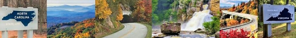
Be sure to read all 3 parts of the posts Blue Ridge Parkway By Sections.
Here are the links to each of the three posts.
- Part 1 Blue Ridge Parkway By Sections – Virginia
- Part 2 Blue Ridge Parkway By Sections – North of Asheville
- Part 3 Blue Ridge Parkway By Sections – South of Asheville
